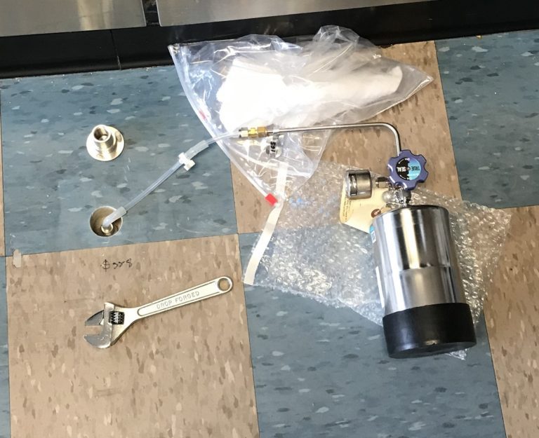
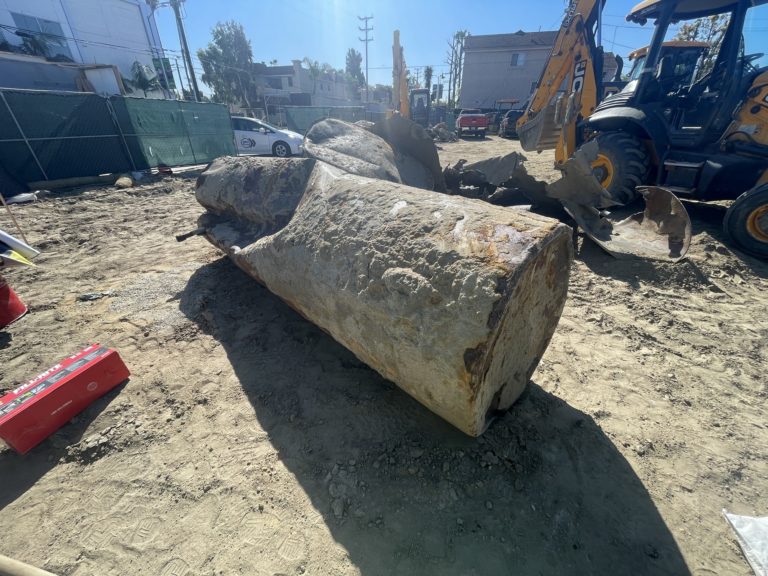
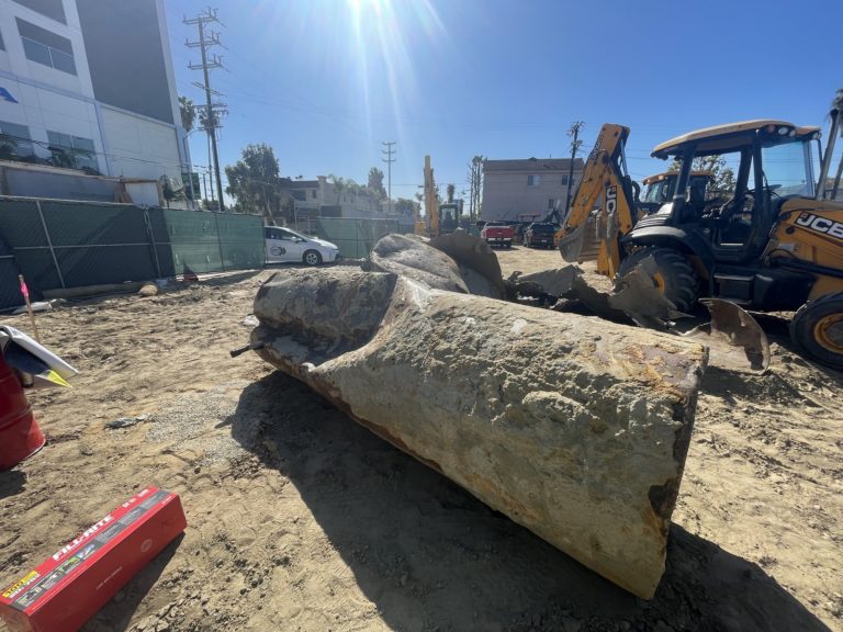
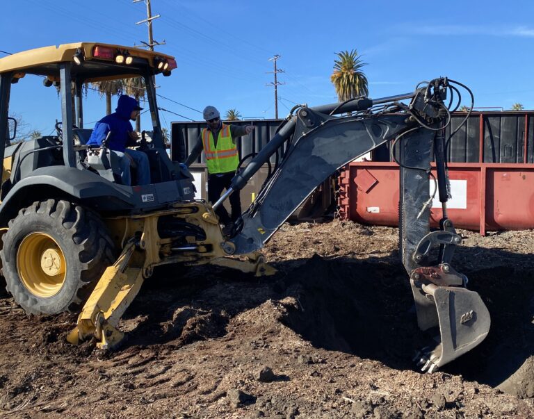
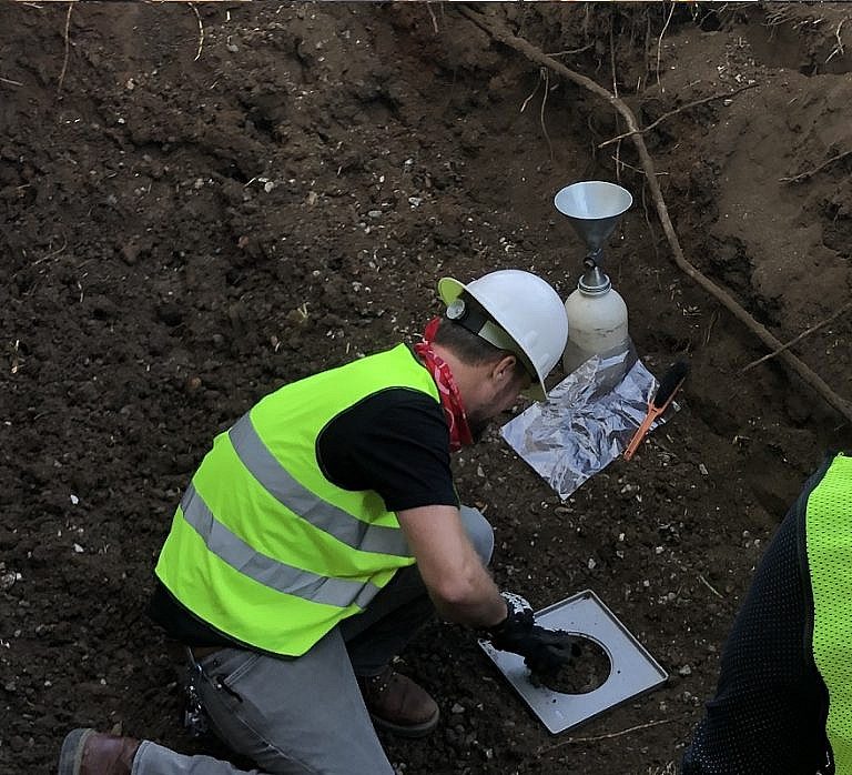
Contact Metamorphism

Contact Metamorphism

Contact Metamorphism Contact Metamorphism – Metamorphism is associated with the intrusion of an igneous mass. Metamorphic changes are caused principally by heat, but also by magma composition and deformation related to the intrusion. Pressures are relatively low (<3000 bars) while temperatures range from 200°C to 1000°C.

Methane Mitigation Soil Gas Pressure Sensor

Methane Mitigation Soil Gas Pressure Sensor

Methane Mitigation Soil Gas Pressure Sensor Methane Mitigation Soil Gas Pressure Sensor: A Methane Mitigation Soil Gas Pressure Sensor is a device that measures and communicates sub-slab soil gas pressure to a methane control panel system. High levels of methane soil gas then trigger the integrated methane alarm system to notify occupants of danger. Much…

Volatile Organic Compounds (VOCs)

Volatile Organic Compounds (VOCs)

Volatile Organic Compounds (VOCs) Volatile Organic Compounds (VOCs): Volatile Organic Compounds are toxic organic chemicals with higher tendencies to change from liquid to vapor phase under typical earth pressures and temperatures, and usually have little-to-no water solubility characteristics. VOCs are commonly found within hydrocarbon-based fuel additives, industrial solvents, refrigerants, hydraulic fluids, degreasers, and more. These…

Total Petroleum Hydrocarbons (TPH)

Total Petroleum Hydrocarbons (TPH)

Total Petroleum Hydrocarbons (TPH) Total Petroleum Hydrocarbons (TPH): The term “Total Petroleum Hydrocarbons” represents the complete carbon chain of hydrocarbon compounds that originate from petroleum. In general there are three ranges of TPH: Gasoline Range Total Petroleum Hydrocarbons (TPH-g); Diesel Range Total Petroleum Hydrocarbons (TPH-d); and Oil Range Total Petroleum Hydrocarbons (TPH-o). Gasoline range TPH represents the…

Maximum Soil Screening Levels (MSLs)

Maximum Soil Screening Levels (MSLs)

Maximum Soil Screening Levels (MSLs) Maximum Soil Screening Levels (MSLs): MSLs are a list of risk-based hydrocarbon concentrations for soil pollution evaluations, that is developed by the California Regional Water Quality Control Board. These screening levels are based on the Leaking Underground Fuel Tanks (LUFT) Manual, for cleaning up soil contamination from leaking USTs. However, MSLs…

Polychlorinated Biphenyl (PCBs)

Polychlorinated Biphenyl (PCBs)

Polychlorinated Biphenyl (PCBs) Polychlorinated Biphenyl (PCBs): Polychlorinated Biphenyl (PCBs) are highly toxic human-engineered chlorinated hydrocarbons that have been used around the world as enhancers to hydraulic oil and electrical insulators. PCBs were applied for maintaining low flammability rates, high boiling points, and stronger chemical stability. As of 1979, PCBs have been banned from use in…

Environmental Compliance Definition

Environmental Compliance Definition

Environmental Compliance Definition Environmental Compliance: Environmental Compliance is the action and fact by which an individual or business complies with every applicable environmental law, standard, code, policy, and regulation. Environmental Compliance is required for any entity to become a qualifying environmentally sustainable organization and is a priority for public health matters and business ethics. Essentially,…

Leaking Underground Storage Tank (LUST)

Leaking Underground Storage Tank (LUST)

Leaking Underground Storage Tank (UST) Leaking Underground Storage Tank (LUST): A leaking underground storage tank (LUST) is a known case of hazardous liquid materials released into the environment, from within an underground storage tank (UST) source. The term “LUST” commonly applies to gasoline station soil contamination cases overseen by environmental regulatory agencies. Also See: Underground…

Underground Storage Tank (UST)

Underground Storage Tank (UST)

Underground Storage Tank (UST) Underground Storage Tank (UST): An underground storage tank (UST) is a confined container occupying any volume of space within the subsurface, for the purposes of storing liquid. Underground tanks typically support commercial and residential services and have filling ports, ventilation pipes, and connecting product pipelines. Underground storage tanks (USTs) come in different…

U-Shaped Kitchen

U-Shaped Kitchen

U-Shaped Kitchen U-Shaped Kitchen: A U-shaped kitchen, or a horseshoe kitchen, is a general kitchen plan layout with counters, walls, and cabinets that generally form a square-like or rectangular-like shape of the letter “u.”  In the State of California (and other states with similar building code standards), U-shaped kitchens must have a minimum of 60-inches…

Gravel Blanket

Gravel Blanket

Gravel Blanket in Methane Mitigation A gravel blanket is a 2-inch or 4-inch thick layer of gravel, sand, or approved material that transmits methane soil gas to the horizontal sub-slab perforated pipes and verticle vent riser of a passive methane mitigation system.

Mechanical Extraction System

Mechanical Extraction System

Mechanical Extraction System Mechanical Extraction System: Per the Los Angeles Department of Building and Safety (LADBS) Methane Code, Ordinance Number 175790, a Mechanical Extraction System is one of the Active Methane Mitigation criteria for methane mitigation systems in buffer zones and methane zones.  A mechanical extraction system uses machines that remove methane gas from below…

Trench Dam

Trench Dam

Trench Dam Trench Dam: Per the Los Angeles Department of Building and Safety (LADBS) Methane Code, Ordinance Number 175790, a trench dam is part of a methane mitigation system. A trench dam is essentially a subsurface barrier that exists within a furrow or ditch, that is adjacent to the foundation of a building in a…

Active Methane Mitigation System

Active Methane Mitigation System

Active Methane Mitigation Active Methane Mitigation: Active systems refer to the mechanical and electrical components of a methane mitigation system. In fact, the definition of an Active System is available in Methane Code (Ordinance No. 175790). This is a publication by the Los Angeles Department of Building and Safety (LADBS). Moreover, further descriptions of an…

Passive Methane Mitigation

Passive Methane Mitigation

Passive Methane Mitigation Passive Methane Mitigation: Passive systems refer to the non-mechanical and non-electric components of the methane mitigation process. These components remove the vapor intrusion risks of methane soil gas migration into buildings atop Los Angeles Methane Zones and Methane Buffer Zones. In fact, methane testing results typically indicate the necessity for a passive…

Control Panel for Methane Mitigation System

Control Panel for Methane Mitigation System

Control Panel in a Methane Mitigation System Control Panel of a Methane Mitigation System: A methane mitigation control panel is the brain behind the active mitigation system. In accordance with the Los Angeles Department of Building and Safety (LADBS) Methane Code, Ordinance Number 175790, a control panel synchronizes methane alarm units with sensors and the…

Methane Alarm System

Methane Alarm System

Methane Alarm System Methane Alarm System: As per the Los Angeles Department of Building and Safety (LADBS) Methane Code, Ordinance Number 175790, a methane alarm system is part of an active methane mitigation plan. A methane alarm system is a group of interacting components and circuits that synchronize to monitor and annunciate the status of…

Unobstructed Opening in Methane Mitigation

Unobstructed Opening in Methane Mitigation

Unobstructed Opening Definition in Methane Mitigation Unobstructed Opening: Per the Los Angeles Department of Building and Safety (LADBS) Methane Code, Ordinance Number 175790, an unobstructed opening is a permanent clearance or gap in the walls, floors, or ceiling of a structure, to allow for direct fresh airflow. In methane mitigation plan applications, this does not…

Single Station Methane Gas Detector

Single Station Methane Gas Detector

Single Station Methane Gas Detector Single Station Methane Gas Detector: As per the Los Angeles Department of Building and Safety (LADBS) Methane Code, Ordinance Number 175790, a single station methane gas detector is a device consisting of electrical components that are capable of measuring methane soil gas concentrations indoors, and initiating an alarm. The single…

Plat Map Definition

Plat Map Definition

Plat Map Definition Plat Map: A plat map provides the metes and bounds of a parcel in a large tract (to scale), as well as the legal land-use rights and limitations. Additionally, it demonstrates locations of streets and public utility easements, as well as ingress and egress easements. And sometimes plat maps provide information about…

De-watering System

De-watering System

De-Watering System in Methane Mitigation De-Watering: In accordance with the Los Angeles Department of Building and Safety (LADBS) Methane Code, Ordinance Number 175790, a de-watering system is a permanent water removal system in a methane mitigation system. In the mitigation process, a de-watering system consists of perforated horizontal pipes, gravel pockets, sump areas with pumps,…

Impervious Membrane

Impervious Membrane

Impervious Membrane in Methane Mitigation Impervious Membrane: In accordance with the Los Angeles Department of Building and Safety (LADBS) Methane Code, Ordinance Number 175790, an impervious membrane is a continuous methane gas barrier. It is a crucial part of the methane mitigation process and underlies a building to impede the vapor intrusion of methane soil gas….

Perforated Horizontal Pipe

Perforated Horizontal Pipe

Perforated Horizontal Pipe in Methane Mitigation Perforated Horizontal Pipe: As per the Los Angeles Department of Building and Safety (LADBS) Methane Code, Ordinance Number 175790, a perforated horizontal pipe is a PVC or ABS pipe that contains a series of small holes or narrow openings placed equidistantly along the length of the pipe, and is…

Design Methane Pressure (Soil Formation Pressure)

Design Methane Pressure (Soil Formation Pressure)

Design Methane Pressure (Soil Formation Pressure) Design Methane Pressure or Soil Formation Pressure: As per the Los Angeles Department of Building and Safety (LADBS) Methane Code, Ordinance Number 175790, Design Methane Pressure means the highest observed measurement of soil formation pressure during the methane testing process. In fact, a Design Methane Pressure measurement that is…

Design Methane Concentration

Design Methane Concentration

Design Methane Concentration Design Methane Concentration: In accordance with the Los Angeles Department of Building and Safety Methane Code, Ordinance Number 175790, a Design Methane Concentration is the highest recorded concentration of methane soil gas detected during the course of methane testing on a property. The Design Methane Concentration is what defines the level of…

Methane Soil Gas

Methane Soil Gas

Methane Soil Gas Methane Soil Gas: In geology, methane soil gas refers to the confinement of CH4 within the interstitial pore spaces of subsurface soils. On Earth and potentially on Mars, methane derives from subsurface pockets of biogenic and petrogenic natural gas. To illustrate, accumulations of buried organic matter decay via microbial or thermal degradation….

Hydrogen Sulfide Soil Gas

Hydrogen Sulfide Soil Gas

Hydrogen Sulfide Soil Gas (In Natural Gas) Hydrogen Sulfide: Hydrogen sulfide (H2S) soil gas geologically occurs upon the thermal and microbial decomposition of subsurface organic material deposits. It is typically identifiable in biogenic and petrogenic natural gas sources, along with higher concentrations of methane soil gas. Additionally, nitrogen, oxygen, hydrogen, ethane, and isobutane exist within natural…

Thermosphere

Thermosphere

Thermosphere Thermosphere: The thermosphere of a terrestrial planet is the fourth and final member of the atmosphere. On Earth, the thermosphere starts atop the mesosphere at approximately 85 kilometers above mean sea level. The upper limit of the thermosphere is reasonably presumed to terminate approximately 95 kilometers above mean sea level. In fact, most of…

Mesosphere

Mesosphere

Mesosphere Mesosphere: The mesosphere of a terrestrial planet is the third member of the atmosphere. On Earth, the mesosphere starts atop the stratosphere at approximately 50 kilometers above mean sea level and terminates roughly 85 kilometers above mean sea level. The mesosphere is where most meteors burn to determination. Like the stratosphere, the air in…

Stratosphere

Stratosphere

Stratosphere Stratosphere: The stratosphere of a terrestrial planet is the second-lowest member of the atmosphere. On Earth, the stratosphere starts atop the troposphere at approximately 10 kilometers above mean sea level, and terminates roughly 50 kilometers above mean sea level. In fact, geologists understand that the Earth’s ozone layer exists within the stratosphere, which absorbs…

Troposphere

Troposphere

Troposphere Troposphere: The troposphere of a terrestrial planet is the lowest member of the atmosphere. On Earth, the troposphere starts atop the ground surface and terminates roughly 10 kilometers above mean sea level. In fact, geologists understand that most of the Earth’s water vapor (clouds) exists in the troposphere. And the next member of the…

Atmosphere

Atmosphere

Atmosphere Atmosphere: The atmosphere of a terrestrial planet is an outermost series of layers that comprises gaseous phase elements within part of the planet’s gravitational field. For instance, the Earth’s atmosphere exists in the air spaces that are approximately 95 kilometers above the ground surface. And within it, are the troposphere, stratosphere, mesosphere, and thermosphere….

Petrogenic Gas

Petrogenic Gas

Petrogenic Gas Petrogenic Gas: In geology, petrogenic gas refers to natural gas that is the byproduct of the thermal decomposition of biological and organic matter. In fact, this is the same process that results in the geological formation of petroleum underground. For instance, methane soil gas hazards in Los Angeles Methane Zones are typically resulting…

Natural Gas

Natural Gas

Natural Gas Natural Gas: In geology, natural gas means combustible hydrocarbon gas that forms by natural geological or biological processes. To illustrate, natural gas that forms by geological processes is the thermal decomposition of buried organic materials. Whereas natural gas that forms via biological processes entail the microbial decomposition of buried organic material. Natural gas…

Biogenic Gas

Biogenic Gas

Biogenic Gas Biogenic Gas: In geology, biogenic gas refers to natural gas that is the byproduct of the microbial decomposition of biological and organic matter. For instance, methane soil gas on Earth is typically a biogenic gas resulting from the decomposition of organic soil zones, landfills, marshes, and swamplands. Alternatively, natural gas can be petrogenic…

Asthenosphere

Asthenosphere

Asthenosphere Asthenosphere: The asthenosphere underlies the lithosphere. The Asthenosphere comprises the upper mantle, where isostatic adjustments are made, and where magma is generated. It is also in this part of the earth, where seismic waves strongly attenuate.

Lithosphere

Lithosphere

Lithosphere Lithosphere: The lithosphere comprises the Earth’s crust as well as part of the upper mantle. In fact, the lithosphere is approximately 100 kilometers thick and is relatively strong as compared to the underlying asthenosphere.

Well Graded

Well Graded

Well Graded Soil Well Graded: In the soil classification process of geology, well graded soil represents a sedimentary soil sample that fully displays all of the possible grain sizes for that soil classification, in accordance with the Unified Soil Classification System (USCS). For example, a well graded sand (SW) comprises fine, medium, and coarse grains…

Poorly Graded

Poorly Graded

Poorly Graded Soil Poorly Graded: In the soil classification process of geology, poorly graded soil represents a sedimentary soil sample that only displays one or a few of the numerous other possible grain sizes for that soil classification, in accordance with the Unified Soil Classification System (USCS). For example, a poorly graded sand (SP) may…

Volcanology

Volcanology

Volcanology Volcanology: Volcanology is a branch of geology that focuses on the study of volcanos. In volcanology, geologists conduct field and laboratory investigations to learn about continental, coastal, and submarine volcanic activities. In fact, volcanology ties into many other branches of geology. For instance, a volcanologist may study the geochemistry of igneous rocks, such as…

Extrusive Rocks

Extrusive Rocks

Extrusive Rocks Extrusive Rocks: In the volcanology branch of geology extrusive rocks are igneous rocks that have been erupted onto the Earth’s surface, before forming and crystallizing. On the other hand, intrusive rocks form and crystallize under the Earth’s ground surface. Extrusive rocks are typically microcrystalline and aphanitic, because of the faster rate of cooling…

Confined Aquifer

Confined Aquifer

Confined Aquifer Confined Aquifer: In the hydrogeology branch of geology, a confined aquifer is an aquifer that is overlain (and underlain) by a layer of low permeability, such as clay, shale, or silty clay. In fact, the two confining layers contain the storage and flow of groundwater, such that the aquifer maintains hydraulic pressure (or…

Unconfined Aquifer

Unconfined Aquifer

Unconfined Aquifer Unconfined Aquifer: In the hydrogeology branch of geology, an unconfined aquifer is an aquifer that has a water table. In fact, an unconfined aquifer can only be the uppermost hydrogeologic unit and is particularly one that has no hydraulic head (or pressure) that is equal to atmospheric pressure. To illustrate, depth to groundwater…

Hydro-Geology (Hydrogeology)

Hydro-Geology (Hydrogeology)

Hydro-Geology (Hydrogeology) Hydro-Geology (Hydrogeology): Hydrogeology is a branch of geology that relates to the study of the earth’s natural groundwater and surface water systems. Whereby geologists study the physical and chemical properties of unconfined aquifers, confined aquifers, river systems, lake beds, oceanwater, natural geysers, and more.

Water Table

Water Table

Water Table Water Table: In the hydrogeology branch of geology, the water table represents the surface of an unconfined groundwater aquifer, where the hydraulic pressure is equal to atmospheric pressure. Additionally, a water table is present in a perched groundwater zone. Although, there is no water table in a confined aquifer.

Epicenter

Epicenter

Epicenter Epicenter: In the seismology branch of geology, an epicenter of an earthquake is the point on Earth’s surface that is directly above the focus (or hypocenter). It is the ground surface location overlying where an earthquake rupture originates within a dip-slip fault or strike-slip fault. Shortly after an earthquake, United States Geological Survey (USGS)…

Focus (Hypocenter)

Focus (Hypocenter)

Focus (Hypocenter) Focus (Hypocenter): In the seismology branch of geology, a focus, or hypocenter, refers to the specific place where an earthquake rupture originates. The focus, or hypocenter, underlies the epicenter when an earthquake occurs at a dip-slip fault, strike-slip fault, oblique-slip fault, or listric fault. In the event of an earthquake, geologists, and seismologists…

Connate Water

Connate Water

Connate Water Definition Connate Water: In geology, connate water is groundwater that has been trapped within the pore space of a sedimentary rock since its original deposition. Connate water is also referred to as “fossil water” due to a long history of non-exposure.

Feldspars

Feldspars

Feldspars Feldspars: In the field of geology, and the branch of mineralogy, feldspars are a mineral group, that is the most common amongst the earth’s crust. In fact, there are two types of feldspars: plagioclase feldspar and orthoclase feldspar.

Alquist-Priolo Earthquake Fault Zoning Act

Alquist-Priolo Earthquake Fault Zoning Act

Alquist-Priolo Earthquake Fault Zoning Act Alquist-Priolo Earthquake Fault Zoning Act: The Alquist-Priolo Earthquake Fault Zoning Act is a law that assists geologists to define “active faults” versus “potentially active faults.” The process entails using the same aging criteria as the United States Geological Survey (USGS) and the California Geological Survey (CGS). In fact, California policy requires…

Transgression

Transgression

Transgression Transgression: In geology, the term transgression is the formation of a specific sequence of sedimentary and metamorphic layers, that are the result of ocean water advancing onto land. To illustrate, when transgression occurs over millions of years, geologists find a layer of sand, overlain by shale, and overlain again by limestone. The opposite of…

Regression

Regression

Regression Regression: In geology, regression is the formation of a specific sequence of sedimentary and metamorphic layers, that are the result of ocean water withdrawing from the land. To illustrate, when regression occurs over millions of years, geologists find a layer of limestone, overlain by shale, and overlain again by limestone. The opposite of regression is…

Growth Fault

Growth Fault

Growth Fault Growth Fault: In geology, a growth fault is a strike-slip fault or dip-slip fault that moves contemporaneously with deposition. This causes the throw (amount of vertical displacement) to increase with depth and the strata to be thicker on the downthrown side as compared to the upthrown side.

Fault Scarp

Fault Scarp

Fault Scarp Fault Scarp: In the field of geology, a dip-slip fault scarp is a steep slope that is formed directly by fault movement. It occurs along the line of a normal fault, reverse fault, or transform fault. A fault scarp represents the planer surface of the fault before erosion and weathering modify it.

Fault Creep

Fault Creep

Fault Creep Fault Creep: Fault creep means slow ground displacement of a strike-slip fault or dip-slip fault, that usually occurs without accompanying earthquakes. Fault creep can derive from tectonic activity, or be the result of excessive petroleum and groundwater pumping.

Facies

Facies

Facies Facies: In the field of geology, the term “facies” represents a mappable, areally restricted part of a rock body that has different fossils or lithology from other contiguous beds deposited at the same time.

Provenance

Provenance

Provenance Provenance: In the field of geology, and the branch of geomorphology, the term “provenance” means the place of origin from which the constituent materials of sedimentary rock or facies are derived.

Environmental Consultant

Environmental Consultant

Environmental Consultant Environmental Consultant: An environmental consultant is an expert of any profession or field, who focuses their skills and knowledge towards matters that improve the environment. Environmental consultants are typically scientists with expertise in geology, chemistry, physics, and engineering. Environmental Consultants Working Towards Environmental Sustainability Environmental consultants generally provide professional services that aim towards…

Terrestrial Planet Definition

Terrestrial Planet Definition

Terrestrial Planet Definition A terrestrial planet is any planet in the universe that has earth-like composition, such as rocks, and other similar solid substances. For instance, Mars is a terrestrial planet in our solar system, whereas Jupiter is not. This is because modern geologists, astrophysicists, and astronomers understand Mars to contain solid formations correlative to…

Engineering Geology & Geological Engineering

Engineering Geology & Geological Engineering

Engineering Geology or Geological Engineering Engineering Geology: Engineering geology is also referred to as “geological engineering,” and is a branch of geology that relates to the study of earth materials and processes, that are juxtaposed to proposed structures such as buildings, retaining walls, dams, roads, pipelines, and more. Whereby geologists assess any potential levels of…

Seismology

Seismology

Seismology Seismology: (seis·mol·o·gy) a branch of geology and geophysics that relates to earthquakes, including but not limited to their causes, effects, hazards, and mitigation techniques.  Seismologists at the United States Geological Survey (USGS) use cutting-edge technology to measure seismic wave properties and geological hazards that trigger them or are triggered by them. In turn, seismology…

Environmental Geology

Environmental Geology

Environmental Geology Environmental Geology: (en·vi·ron·men·tal ge·ol·o·gy) a branch of geology that relates to the impact of human activity on Earth, and the pollution of geologic formations, reserves, and resources. Common focus points of environmental geology are contaminated soil, groundwater aquifers, lakes, rivers, and the ocean. Professional geologists assess and remediate contamination plumes in all media,…

Waterproofing Barrier System

Waterproofing Barrier System

Waterproofing Barrier System Definition A waterproofing barrier system guarantees full protection to walls, foundations, and methane mitigation systems that are below grade and are susceptible to moisture penetration. Typically, the best way to protect a retaining wall against moisture is the application of a waterproofing barrier on the backside of it, after pouring concrete, but…

Strike-Slip Fault (Transform Fault) Definition

Strike-Slip Fault (Transform Fault) Definition

Strike-Slip Fault or Transform Fault Strike-Slip Fault (Transform Fault): In the field of geology, a strike-slip fault, or a transform fault, is a fault in which movement is parallel to the strike of the fault plane. The opposite of a strike-slip fault is a dip-slip fault. Left-Lateral or Right-Lateral Strike-Slip Fault A transform fault can…

Normal Fault Definition

Normal Fault Definition

Normal Fault Normal Fault: In the field of geology, a normal fault is a type of dip-slip fault where the hanging wall moves downwards from the footwall. The average dipping angle of a normal fault ranges from 45 to 90 degrees. Normal faults are the opposite of reverse faults. Detachment Fault Detachment Fault: A detachment…

Reverse Fault Definition

Reverse Fault Definition

Reverse Fault Reverse Fault: In the field of geology, a reverse fault is a dip-slip fault in which the hanging wall moves upwards, relative to the footwall. The average dipping angle of a reverse fault ranges from 45 to 90 degrees. However, if less than 45 degrees, it becomes a “thrust fault.” Reverse faults are…

Thrust Fault Definition

Thrust Fault Definition

Thrust Fault Thrust Fault: In the field of geology, a thrust fault is a reverse fault in which the fault plane dipping angle is less than 45 degrees. Thrust faults are dip-slip faults, and can also be listric faults. For instance, the fault underlying the western embankment of the historical St. Francis Dam in Saugus,…

Concrete Arch Dam

Concrete Arch Dam

What is a Concrete Arch Dam? A Concrete Arch Dam is a curved freshwater-retaining structure that is concave in the hydro-geologically down-gradient direction, and uniformly thick from the base to top. With Concrete Arch Dams, a major part of the water load value gets distributed to the abutments of the dam. Thus, Concrete Arch Dams…

Embankment Dam

Embankment Dam

What is an Embankment Dam? An Embankment Dam is a freshwater-retaining structure comprising excavated rock, soil, or a combination of rock and soil from nearby geological formations.  In fact, Embankment Dams are known as an “Earthfill Dam” when filled with soil, and a “Rockfill Dam” when filled with rocks. Earthfill Dams are most common. The…

Concrete Gravity Dam

Concrete Gravity Dam

What is a Concrete Gravity Dam? A Concrete Gravity Dam is also known as “Gravity Arch Dam,” and is a freshwater-retaining concrete structure that has a wider footing (base) than the top-section. The purpose of a Concrete Gravity Dam is to maintain a low center of gravity, in order to avoid collapsing in the event…

Seismic Risk Definition

Seismic Risk Definition

Seismic Risk Definition Seismic risk is the probability that a subject site will be adversely affected by any seismic hazard, such as an earthquake. Seismic risk tends to increase in areas that are more earthquake-prone and vulnerable to damage. And vulnerability refers to the potential impact on people, as well as properties. For instance, places…

Monoculture Definition

Monoculture Definition

Monoculture Definition The term “Monoculture,” in the fields of farming and agriculture, refers to a cultivation system that comprises only one organism. For instance, an entire crop field that only grows carrots. In a monoculture, there is no symbiosis between different species. As a result, there isn’t any comingling with other organisms. In fact, for…

Type Section

Type Section

Type Section Geologic Definition In geology, the term “type section” refers to a specific stratigraphic unit, that can be compared to other parts of the geologic unit. For a type section, it’s preferred to describe the location where the geologic unit has the maximum thickness, and where the top and bottom units are observable.

Rock Stratigraphic Unit

Rock Stratigraphic Unit

Rock Stratigraphic Unit In the field of geology, a rock stratigraphic unit, or a lithostratigraphic unit, is a geologic formation that is identifiable by a specific lithology, as well as a consistent stratigraphic position. For example, the Monterey Formation is a rock stratigraphic unit, as it tends to consistently comprise the same gravel and sand…

Zeolites

Zeolites

Zeolites Definition In geology, zeolites are a group of hydro-alumino-silicate minerals that are compositionally analogous to the feldspars. Zeolites typically comprise sodium (Na), calcium (Ca), or potassium (K) as chief metals. And zeolites also tend to develop within basalt cavities, lake sediments, oceanic sediments, and volcanic tuff. Modern Economical uses of the Zeolites Modernly, zeolites…

Index Fossil

Index Fossil

Index Fossil Definition An Index fossil, in the field of paleontology, refers to a fossil that identifies and dates the stratigraphic unit that it is observed to exist in. Index fossils can combine a wide geographic range. And they can really narrow down the classifications of most stratigraphic units.

Intrusive Rocks

Intrusive Rocks

Intrusive Rocks In the volcanology branch of geology, intrusive rocks are igneous rocks that form and crystallize under the Earth’s ground surfaces, within other geologic formations. In fact, intrusive rocks form by the process of magma shooting through pre-existing sedimentary, igneous or metamorphic rocks. For instance, a pegmatite dyke or a batholith. On the other…

Aphanitic

Aphanitic

Aphanitic Definition Aphanitic: In geology, the term aphanitic describes the texture of plutonic or volcanic igneous rocks, with grains that are not visible to the naked eye. In fact, an aphanitic texture is usually the result of faster cooling and solidification of liquid magma.

Phaneritic

Phaneritic

Phaneritic Definition In geology, the term Phaneritic applies to the texture of an igneous rock. A phaneritic plutonic rock has grains that are large enough to be seen with the naked eye. In fact, this indicates there was a slower rate of magmatic cooling.

Silicates

Silicates

Silicates Definition In the fields of geology and mineralogy, the term “silicates” refers to compounds whose crystal structure contains SiO4 tetrahedra. Silicates are either isolated or joined to form groups, rings, single or double chains, sheets, or three-dimensional frameworks.

Rigidity

Rigidity

Rigidity Definition Rigidity – In geotechnical engineering and engineering geology, rigidity represents the ratio of the shear stress and the amount of angular rotation that it produces, within a rock sample.

Rotational Slide (Slump)

Rotational Slide (Slump)

Rotational Slide (Slump) Definition Rotational Slide (Slump):  A rotational slide is a type of landslide movement that occurs in a turning moment, about a pivot point that is above the center of gravity. This is typically due to an increased normal force on a slope, as well as a reduced cohesion factor of the soil…

Settlement

Settlement

Settlement Definition In the field of geology, The term settlement means a gradual downward movement of the ground surface. This is generally due to soil compression at on a larger scale, atdepths that are below the ground surface.

Seiche

Seiche

Seiche Definition The term “Seiche” in geology refers to a wave-oscillation, that comes from any surface body of water, that is initiated by an earthquake or changes in atmospheric pressure. For instance, the rippling waters of a lake or at the bay of an ocean.

Translational Slide Definition

Translational Slide Definition

Translational Slide Landslide Translational Slide: In the seismology branch of geology, a translational slide is a type of landslide movement that occurs predominantly along a planar surface. Alternatively, this movement can occur along gently undulating surfaces. For instance, the Palona Schist metamorphic bedrock on the eastern embankment of the former St. Francis Dam comprises an…

Toe of a Slope

Toe of a Slope

“Toe” of a Slope Definition The “toe” of a slope is essentially the bottom, or baseline section, of the soil mass comprising the slope. It is also defined as the outermost margin of displaced material during a landslide. The toe of a slope is farthest away from the head scarp.

Geology

Geology

Geology Geology: Geology is a field of science relating to the earth, including but not limited to the earth’s resources, physical processes, chemical properties, history, and future. Additionally, the science of geology includes the study of other terrestrial planets, such as Mercury, Venus, or Mars. Branches of Geology There are numerous branches of geology that…

Darcy’s Law

Darcy’s Law

Darcy’s Law In the field of geology, Darcy’s Law is the universal and basic equation representing groundwater flow through a study area. Darcy’s Law Formula Q = KiA The following variables and coefficients apply to this formula: “K” = Hydraulic Conductivity; “Q” = Discharge Rate; “A” = Area of Cross-Section that Water Flows;

Mineraloid

Mineraloid

Mineraloid Definition The term “mineraloid” refers to a natural earth substance that appears to be similar to a genuine mineral, although lacks any form of internal structure and crystal form. Nonetheless, a mineraloid does comprise true minerals within it. For instance, Fire Opal and Blue Opal are not minerals because they are amorphous (do not…

Mineral

Mineral

Mineral Definition A mineral is defined as an inorganic element, compound, or substance that naturally develops with an organized internal structure and/or crystal form over time. Minerals are also distinguishable by their chemical composition and physical properties, as determined in laboratories by geologists. Typical earth minerals found in most igneous, metamorphic, and sedimentary rocks are…

Metamorphic Rock

Metamorphic Rock

Metamorphic Rock Definition In the field of geology, the term “Metamorphic Rock” refers to a rock classification that is the result of the alteration of prior existing sedimentary rocks or igneous rocks. The alteration process is “metamorphosis, and can take place by various methods and environments. The metamorphosis process produces specific metamorphic rocks, on the…

Sedimentary Rock

Sedimentary Rock

Sedimentary Rock Definition In geology, the term “Sedimentary Rock” refers to the classification of rock that is the result of the gradual consolidation and deposition of loose particles of other rock classifications (igneous or metamorphic). Alternatively, sedimentary rocks can also form by the accumulation and precipitation of other natural chemical solutions in a depositional environment….

Volcanic Rock (Igneous)

Volcanic Rock (Igneous)

Volcanic Rock (Igneous) Definition A “Volcanic Rock” is an igneous rock that is finely crystalline and glassy (or aphanitic). To illustrate, volcanic rocks result from volcanic action at the earth’s surface. Typically, this also includes igneous intrusions that are “near-surface,” which may otherwise be considered plutonic. This action results in a final rock that is…

Igneous Rock

Igneous Rock

Igneous Rock Definition In the field of geology, the term “Igneous Rock” refers to one of the three major classifications of rock that comprises the earth. As opposed to sedimentary rocks or metamorphic rocks, igneous rock derives from the direct cooling and solidification of magmatic material. Igneous rock comprises a large amount of the planet…

Geologic Time Scale
|

Geologic Time Scale

Geologic Time Scale The Geologic Time Scale is an international system used by geologists to classify and identify major geologic events and formations. The geologic timescale essentially categories the earth’s entire geologic (and biologic) history, within a series of defined eons, eras, periods, epochs, and ages. Updates & Maintenance The geologic time scale is continuously…

Plutonic Rock (Igneous)

Plutonic Rock (Igneous)

Plutonic Rock (Igneous) Definition The term “Plutonic” in the field of geology refers to an igneous rock, wherein the magma had originally cooled, solidified, and crystalized underground. A plutonic rock is generally coarsely crystalline (phaneritic) and is formed during a massive geologic intrusion of magma. In fact, outcropping (or daylighting) plutonic rocks are geologic features…

Tsunami

Tsunami

Tsunami Tsunami: In the seismology branch of geology, a tsunami is an oceanic wave (gravitational) that is produced by seismic activity on the ocean floor. Common triggers of tsunamis are large-scale short­ duration earthquakes, volcanic eruptions, or other submarine earth movements such as subsidence and slope failure.

Subsidence

Subsidence

Subsidence “Subsidence” is a geologic condition, in which a localized mass movement occurs, resulting in the downward settlement of the earth over time. When subsidence occurs, the actual ground surface elevation is lower. This occurrence of the ground surface sinking is typically caused by groundwater table and aquifer reductions, by which the soils become more…

Potentiometric Surface

Potentiometric Surface

Potentiometric Surface The term “Potentiometric Surface” means the hydrogeological surface that represents the total hydraulic head of groundwater from a confined aquifer or semi-confined aquifer that’s under pressure. The Potentiometric Surface of an aquifer is defined by the level to which water will rise in a groundwater monitoring well (that’s exclusively screened within said aquifer).

Permeability

Permeability

Permeability “Permeability” in engineering geology and geotechnical engineering refers to the property of a soil sample (or porous rock) which relates to transmitting a fluid within. Permeability measures the relative case of flow under unequal pressure. Permeability is calculated using Darcy’s Law.

Hydraulic Conductivity (K)

Hydraulic Conductivity (K)

Hydraulic Conductivity (K) “Hydraulic Conductivity” (K), in hydrogeology and hydrology, represents the capacity of a porous medium (such as soil) to transmit water, as per Darcy’s Law. To illustrate, the rate at which fluid can move through a permeable medium (such as soil), depends on the properties of that soil (such as intrinsic permeability) and…

Porosity (n)

Porosity (n)

Porosity (n) “Porosity” (n), in the geological engineering field, is a percentage value that represents the bulk volume of a rock or soil, that is occupied by the void space within. Porosity (n) Formula Porosity (n) = [(Volume of Voids ÷ Total Volume) x 100%]

Licensed Professional Geologist

Licensed Professional Geologist

Licensed Professional Geologist A “Licensed Professional Geologist” or a “Certified Professional Geologist” is a person who is certified by a State and/or Federal agency (such as the California Department of Consumer Affairs, Board for Professional Engineers, Geologists & Land Surveyors), and has proven be educated, formally trained and professionally competent per government standards, to practice…

Consistency

Consistency

Consistency The term “Consistency” in the fields of engineering geology and geotechnical engineering means the degree of adhesion between soil particles within a sample, that are observed to resist deformation or rupture.

Consolidation

Consolidation

Consolidation “Consolidation” in geology refers to the gradual or slow reduction in the volume of a soil sample (representing a larger soil mass), and the increase in density in response to an applied increasing load, or compressive stress.

Gap-Graded

Gap-Graded

Gap-Graded The term “Gap-Graded” is used by geologists, engineers, and soil scientists in the geotechnical engineering field to describe the gradation of a soil sample, specifically when some particle sizes are missing. Aside from being “gap graded,” a soil sample can be described as “well-graded” (also referred to as poorly sorted), or “poorly graded” (or…

Effective Size (D10)

Effective Size (D10)

Effective Size (D10) “Effective Size” (D10) is an engineering geology term. Effective Size represents a diameter that directly corresponds to the percentage, by weight, of grains that equal to 10% on the grain-size diagram. To illustrate, 10% of the soil sample particles are finer-grained, and 90% of the sample particles are coarser than the “effective…

Effective Stress (σ’)

Effective Stress (σ’)

Effective Stress (σ’) “Effective Stress” (σ’) is a geotechnical engineering term. Effective Stress is a function of “total stress,” and is due to the solid particles of soil. Effective stress represents an excess of stress above pore-water pressure (or neutral stress). Effective Stress Formula Effective Stress = Total Stress – Pore-Water Pressure.

Liquefaction

Liquefaction

Liquefaction Liquefaction: Liquefaction is the process by which there is: (1) a sudden and significant decrease of shear resistance in a soil sample (cohesion-less); (2) a sudden (but temporary) increase of the pore-water pressure of a substance; and (3) a solid mass of soil that is transformed into a fluid state mass. In the event…

Liquid Limit (LL)

Liquid Limit (LL)

Liquid Limit (LL) “Liquid Limit (LL)” in the field of geological engineering, refers to the upper limit of the “plastic state.” This is a separation of the plastic phase and viscous liquid phase when measuring soil consistency. Mathematically, it is the water content (basing on the percent of dry weight), at which two sections of…

Dry Density (ρd)

Dry Density (ρd)

Dry Density (ρd) “Dry Density” (ρd) is a value that represents the density of soil when it is completely dry. To illustrate, it equates to (“bulk density” / 1) + “water content.” This is a common geotechnical engineering laboratory procedure. Dry Density Formula Dry Density = [(Bulk Density ÷ 1) + (Water Content)]

Dry Strength

Dry Strength

Dry Strength “Dry Strength” is a value that represents the strength of a soil sample, when dry, as determined by the crushing test. There is a common geotechnical engineering laboratory procedure for determining the cohesiveness or plasticity of a sample with organic or inorganic clays and silts.  

Hardpan (Caliche)

Hardpan (Caliche)

Hardpan (Caliche) “Hardpan” is a highly dense and solid layer of soil near the ground surface, which is usually comprised of clay or silty-clay soils. Hardpan forms by cementation over time, during the process of precipitation of insoluble substances such as calcium carbonates, silica, iron oxides, and other organic matter. “Hardpan” is a term mostly…

Environmental Law

Environmental Law

Environmental Law Environmental Law refers to the various categories of law that are put in place to protect the quality and condition of the earth and the environment. This sect of law aims to protect the well being of people and to preserve the earth’s natural resources, reserves, and wildlife. In fact, environmental laws apply…

Retaining Wall

Retaining Wall

Retaining Wall Retaining Wall: A structure that provides the support needed to hold (in place) a mass of earth, preventing it from moving downhill. Retaining walls are relatively rigid structures comprising footings and a drainage system, in order to retain the soils between two different elevations. Updated May 25, 2020. Construction & Design A lot…

Environmental Professional Definition
| |

Environmental Professional Definition

Environmental Professional Definition Environmental Professional: As per the EPA’s All Appropriate Inquiries Rule, an environmental professional is an environmental consultant that has an accredited education in earth or natural science, at least five years of formal training under another environmental professional, a professional state license, and maintains expert knowledge in the environmental geology, sustainability, and…

Soil Compaction Testing and Soil Density Testing

Soil Compaction Testing and Soil Density Testing

Soil Compaction Testing or Soil Density Testing Soil compaction testing, or soil density testing, is the process by which the density property of a soil mass is increased in the field by various means, and monitored by a professional geologist in accordance with local building department specifications. During the placement of engineered backfill material, density…