Consolidation
“Consolidation” in geology refers to the gradual or slow reduction in the volume of a soil sample (representing a larger soil mass), and the increase in density in response to an applied increasing load, or compressive stress.
“Consolidation” in geology refers to the gradual or slow reduction in the volume of a soil sample (representing a larger soil mass), and the increase in density in response to an applied increasing load, or compressive stress.

Fault Creep Fault Creep: Fault creep means slow ground displacement of a strike-slip fault or dip-slip fault, that usually occurs without accompanying earthquakes. Fault creep can derive from tectonic activity, or be the result of excessive petroleum and groundwater pumping.
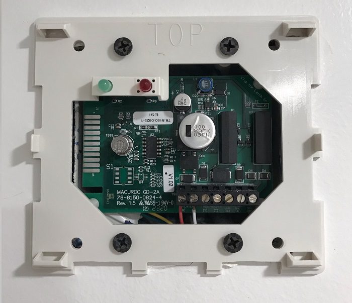
Methane Alarm System Methane Alarm System: As per the Los Angeles Department of Building and Safety (LADBS) Methane Code, Ordinance Number 175790, a methane alarm system is part of an active methane mitigation plan. A methane alarm system is a group of interacting components and circuits that synchronize to monitor and annunciate the status of…
Cation Cation: In the fields of chemistry and geochemistry, a cation is a positively charged ion. The oppositely charged ion is an anion.
Adsorption “Adsorption” in geology, refers to the attraction and adhesion of the ions or molecules of a solution, onto the surface of a solid.
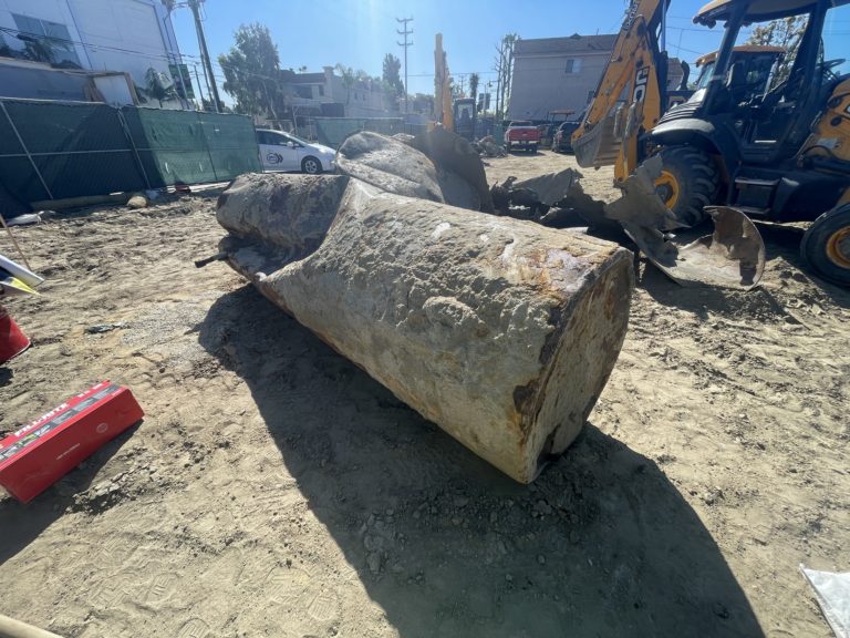
Leaking Underground Storage Tank (UST) Leaking Underground Storage Tank (LUST): A leaking underground storage tank (LUST) is a known case of hazardous liquid materials released into the environment, from within an underground storage tank (UST) source. The term “LUST” commonly applies to gasoline station soil contamination cases overseen by environmental regulatory agencies. Also See: Underground…
Milliequivalent per liter Milliequivalent per liter (meq/L): A unit used to express the chemical equivalence of the concentration of solutes in a solution. It is calculated by dividing the concentration of a substance (in mg/L) by its equivalent weight. This measurement helps in understanding the reactive capacity of ions in the solution.