Similar Posts
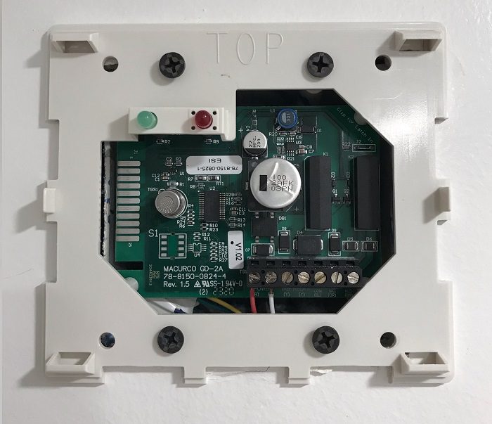
Methane Alarm System
Methane Alarm System Methane Alarm System: As per the Los Angeles Department of Building and Safety (LADBS) Methane Code, Ordinance Number 175790, a methane alarm system is part of an active methane mitigation plan. A methane alarm system is a group of interacting components and circuits that synchronize to monitor and annunciate the status of…
Methane Mitigation Soil Gas Pressure Sensor
Methane Mitigation Soil Gas Pressure Sensor Methane Mitigation Soil Gas Pressure Sensor: A Methane Mitigation Soil Gas Pressure Sensor is a device that measures and communicates sub-slab soil gas pressure to a methane control panel system. High levels of methane soil gas then trigger the integrated methane alarm system to notify occupants of danger. Much…
Plat Map Definition
Plat Map Definition Plat Map: A plat map provides the metes and bounds of a parcel in a large tract (to scale), as well as the legal land-use rights and limitations. Additionally, it demonstrates locations of streets and public utility easements, as well as ingress and egress easements. And sometimes plat maps provide information about…
Lumber Moisture Content Grade
Lumber Moisture Content Grade Lumber moisture grading is a manufacturer-provided value of moisture content, for consumers and contractors to use. There are five (5) lumber moisture content designations (S-GRN, S-DRY, KD, MC 15, and HT). Lumber Moisture Grading Lumber grade “S-GRN” stands for “surface green,” which means it is not dry, and has a moisture…
Total Petroleum Hydrocarbons (TPH)
Total Petroleum Hydrocarbons (TPH) Total Petroleum Hydrocarbons (TPH): The term “Total Petroleum Hydrocarbons” represents the complete carbon chain of hydrocarbon compounds that originate from petroleum. In general there are three ranges of TPH: Gasoline Range Total Petroleum Hydrocarbons (TPH-g); Diesel Range Total Petroleum Hydrocarbons (TPH-d); and Oil Range Total Petroleum Hydrocarbons (TPH-o). Gasoline range TPH represents the…
Environmental Compliance Definition
Environmental Compliance Definition Environmental Compliance: Environmental Compliance is the action and fact by which an individual or business complies with every applicable environmental law, standard, code, policy, and regulation. Environmental Compliance is required for any entity to become a qualifying environmentally sustainable organization and is a priority for public health matters and business ethics. Essentially,…