Similar Posts
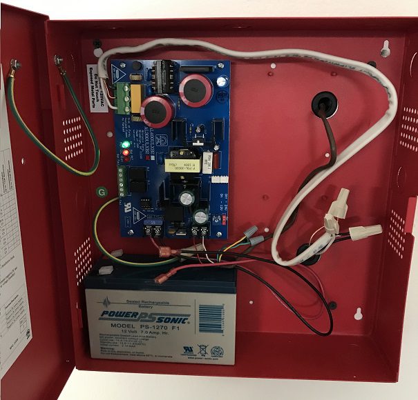
Control Panel for Methane Mitigation System
Control Panel in a Methane Mitigation System Control Panel of a Methane Mitigation System: A methane mitigation control panel is the brain behind the active mitigation system. In accordance with the Los Angeles Department of Building and Safety (LADBS) Methane Code, Ordinance Number 175790, a control panel synchronizes methane alarm units with sensors and the…
Well Graded
Well Graded Soil Well Graded: In the soil classification process of geology, well graded soil represents a sedimentary soil sample that fully displays all of the possible grain sizes for that soil classification, in accordance with the Unified Soil Classification System (USCS). For example, a well graded sand (SW) comprises fine, medium, and coarse grains…
Dry Strength
Dry Strength “Dry Strength” is a value that represents the strength of a soil sample, when dry, as determined by the crushing test. There is a common geotechnical engineering laboratory procedure for determining the cohesiveness or plasticity of a sample with organic or inorganic clays and silts.
Vapor Intrusion
Vapor Intrusion Vapor Intrusion occurs when harmful soil contamination changes phase from liquid to vapor underground and moves upward through geologic layers and building foundations, accumulating within indoor air.
Diagenesis
Diagenesis Diagenesis: In geology, diagenesis refers to the physical and chemical changes of a sedimentary formation when compaction and lithification occur over time.